
A building that appeared to be the old Rienzi School, which closed in 1948, was still standing in 2022. (SCHS)
This entry has been expanded. See “Hat tips” below.
Sangamon County doesn’t have the kind of ghost towns sometimes portrayed in Western movies. But a variety of vanished or forgotten place names dot the county, each of which tells its own snippet of local history.
When John Carroll Power and his wife Sarah compiled their 1876 History of the Early Settlers of Sangamon County, Illinois, they included a list and map of post offices at the time. Many of those post offices were simply country stores where it was convenient for farmers to pick up mail prior to creation of Rural Free Delivery. About half of the post offices on Power’s list later went out of business. Some of the locales they served have been absorbed by bigger towns, while others changed their names. Some vanished.
The following list of former place names in Sangamon County is based on an article by W.D. Barge, “The Old Towns of Illinois” published in the Illinois State Historical Society’s 1912 Transactions in Illinois History; on Power’s compilation of post offices; and on newspaper archives. However, Barge’s foreword to his list of statewide names probably applies to this Sangamon County collection as well:
In reading the various books containing information of our State, it was noticed that the names of many of the towns had been changed, and that some of the towns had ceased to exist. Many of them were mere town sites, and others were towns under the township organization law. …
The list is NOT complete. It contains errors. … (But) it is hoped that the list will be of service to those who want to know something more of our State.
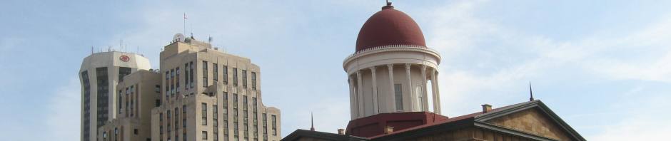
The Springfields

An 1892 map of Springfield shows the suburbs of Ridgely, West Springfield and South Springfield. North Springfield, already annexed, is the rectangular addition to the north city limits that includes the Illinois Watch Factory and Ursuline Convent. (Hat tip: Thanks to Curtis Mann of Lincoln Library’s Sangamon Valley Collection)
The city of Springfield, restricted to “inside the avenues” – North, South, East and West Grand avenues (East Grand became Martin Luther King Drive; West Grand was renamed MacArthur Boulevard) – couldn’t keep up with itself in the late 19th century.
As a result, residents of a half-dozen growing neighborhoods around the city’s edges formed their own municipalities. They mostly adopted unoriginal names, so the original Springfield quickly became ringed by the villages of East, North, South and West Springfield, plus those of Laurel and Ridgely.
Their populations ranged from a few hundred to about 1,500; all were too small to provide basic municipal services like fire protection and sidewalks, not to mention regulate street cars or install water lines. On the other hand, taxes were low, and the village governments were usually able to ban liquor sales and saloons, a major political issue during the period.
It took two decades of controversy and special elections, but all six villages eventually became part of greater Springfield. The first to annex was North Springfield (pop. 1,000, generally north of North Grand to about today’s Lincoln Park) whose voters approved annexation in April 1891. West Springfield (pop. 700, generally the area around today’s Dubois Elementary and Sacred Heart-Griffin High schools), followed in December 1897.
South Springfield (pop. 600, south of South Grand between the Third Street and 10th Street railroad lines) and Laurel (the six blocks south of South Grand between Third Street and West Grand) both voted in April 1898 to annex to greater Springfield.

John Carroll Power’s list of Sangamon County post offices, 1876
Ridgely (pop. 1,000, northeast Springfield – see separate entry) joined the city in March 1907.
The last holdout, East Springfield, was the largest of the suburbs, with 1,500 residents. East Springfield ran from Moffat to South Grand avenues east of East Grand. Voters in the village defeated an annexation proposal by 14 votes in July 1908. A mini-scandal in that election – two East Springfield election judges eventually pleaded guilty to aiding an illegal voter – led to another vote in September 1908. That time, village voters okayed annexation, 192-133, but a judge threw out the results on an election technicality. East Springfield finally approved annexation by a vote of 216-113 in April 1909. Hat tip: Thanks to contributor Mary Frances for correcting SangamonLink’s chronology of the East Springfield annexation effort.
Name changes
- Calhoun: The city of Springfield was platted as Calhoun, to recognize U.S. Sen. John C. Calhoun. But the area was known as Springfield before platting, and Calhoun never caught on.
- Judy’s Ferry/Jamestown (or “Jimtown”)/Howlett: Former names for what eventually became Riverton. The name “Jamestown” apparently came from James Frazier Reed, co-leader (and survivor) of the ill-fated Donner Party. “Howlett” was for Parley Howlett, who discovered a rich seam of coal there while drilling for oil. Hat tip: SangamonLink thanks reader Alan Franklin for the reminder.
- Benton: Original name of Williamsville.
- Horse Creek: Original name of Pawnee.
- Pawnee Junction: Another name for Cimic, just west of the intersection of Illinois 104 and Interstate 55 on the edge of Divernon. Cimic was/is an anagram of the names of two railroads, the Chicago and Illinois Midland and the Illinois Central. (The C&IM began as the Pawnee Railroad, built by farmers and citizens of Pawnee in the 1880s; see separate entry.) Hat tip: SangamonLink thanks reader Mike Gorman for the addition.
- Springer: Original name of Divernon.
- Clarksville, Custer, Mortarsville, and South Fork: All apparently former names for Berry.
- Wilson: Original name of Illiopolis.
- New Harmony: Early name for Breckenridge.
- Wheatfield and Power townships: Original names of 2022’s Lanesville and Fancy Creek townships.
- Sackett/Salisbury township: Sackett was the original name of Salisbury Township, but Salisbury itself was dissolved in 1989; its territory was divided between Fancy Creek and Gardner townships.
Disappeared
- Cotton Hill: Flooded by Lake Springfield in the 1930s.
- Sangamo Town: Failed in mid-1800s after its rival, Springfield, was chosen county seat.
- Cicero: Proposed 1830s’ town development northeast of Springfield (Buffalo Hart/Fancy Creek area). Would-be developers were Archibald Constant and John Latham. According to Barge, Cicero was dissolved in 1845.
- Iles Junction: While never a discrete community of its own, Iles Junction south of Springfield was another important railroad junction. According to Power’s list, it boasted a post office in the 1870s.
School sites
Some unincorporated communities eventually became known as the sites of country schools. Those names, however, tended to fade after one-room schoolhouses were consolidated into larger school districts starting after World War II.
Among them was Rienzi in the far southeastern corner of Sangamon County, near Lake Sangchris. Rienzi (the name probably came from Rienzi, Miss.) was “vacated” in 1851, according to a contemporary report in the Illinois State Journal (Hat tip: thanks to William Cellini Jr. for additional information), but a schoolhouse existed there until 1948. Again according to the Journal, the building was sold at auction in 1949 to a group of sportsmen, who held fox hunts there for at least a year or two.
![]() Carroll’s post office list includes two, Cross Plains and Richland, that also were the sites of country schools that eventually were consolidated into the Pleasant Plains School District. Richland Road, which runs north-south in western Sangamon County, and Richland Baptist Church near Salisbury keep that name alive.
Carroll’s post office list includes two, Cross Plains and Richland, that also were the sites of country schools that eventually were consolidated into the Pleasant Plains School District. Richland Road, which runs north-south in western Sangamon County, and Richland Baptist Church near Salisbury keep that name alive.
Original content copyright Sangamon County Historical Society. You are free to republish this content as long as credit is given to the Society. Learn how to support the Society.
I wish there was a map of the old Springfield’s. That would be neat to see
Thanks for this very interesting article. It reminds me of a favorite research book “Illinois Place Names”.
At one point my double-great grandfather William Holland Park had an address in Rienzi. The family were very engaged in Cotton Hill history; see PORTRAIT & BIOGRAPHICAL ALBUM OF SANGAMON COUNTY, ILLINOIS
Chicago: Chapman Brothers, 1891.